




Morecambe Bay
Overview
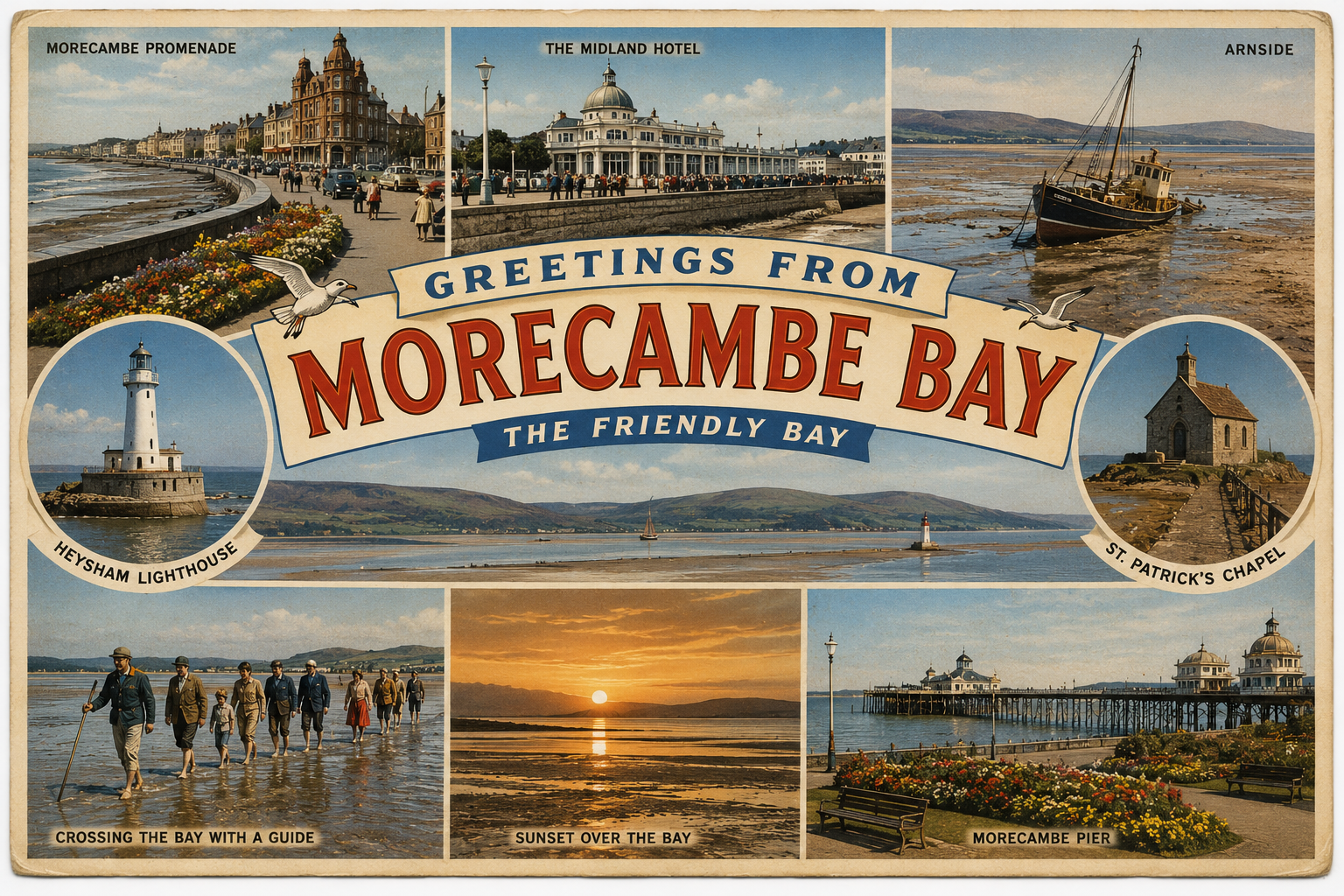
Morecambe Bay is a broad, shallow estuarine area on the northwest coast of England, formed by the confluence of several rivers. It is characterised by expansive intertidal flats, shifting channels, and a strong tidal regime. The coastline includes a mix of low-lying shores, small settlements, and estuarine inlets.
The area has a long association with coastal navigation, though it is generally approached with caution due to its dynamic seabed and rapidly changing conditions. Navigation routes may alter over time, and local knowledge is often considered important.
Local Operating Context (for Liveaboard Boaters)
For liveaboard boaters, Morecambe Bay presents a setting that can be workable but requires careful planning. The large tidal range significantly influences access, anchoring options, and movement within the bay.
Settlements around the bay provide general points of shore access, though direct marine facilities are limited and conditions may restrict landing opportunities depending on tide and weather.
The shifting nature of channels and sandbanks means that charts may not always reflect current conditions. Conservative passage planning and timing around tides are typically necessary.
Exposure to weather systems moving in from the Irish Sea can affect comfort and safety, particularly in more open sections of the bay.
Typical Conditions
- Large tidal range with extensive drying areas at low water
- Frequent changes in channel alignment and depth
- Open exposure to westerly winds in outer sections
- Variable water clarity and sediment movement
Access & Shelter
- Access often limited to certain states of the tide
- Shelter may be found in estuarine inlets but is often partial
- Anchoring conditions vary depending on seabed composition
- Entry routes can be uncertain due to shifting sands
Shore Interaction
- Landing points may be affected by mudflats and tidal retreat
- Access to shore can require careful timing
- Settlements provide general access to inland services
- Intertidal areas may present difficult footing
Risk Factors
- Rapidly advancing tides across flat areas
- Unpredictable sandbanks and shallow zones
- Limited shelter in changing weather
- Potential for grounding if routes are misjudged
Overall Character
Morecambe Bay has a quiet and expansive character, shaped by tidal movement and sediment. It offers a sense of space and isolation, but its conditions often require a cautious and adaptable approach to navigation and living aboard.
Notable Locations
-
Morecambe – Coastal town on the bay’s western edge, offering general shore access and views across open water.
-
Grange-over-Sands – Located on the northern shoreline, with access influenced by tidal retreat and mudflats.
-
Arnside – Estuarine village where tidal flows can be pronounced, particularly in narrow channels.
-
Walney Island – Forms part of the bay’s outer boundary, with more exposed coastal conditions.
Practical Mooring & Anchorage Locations
Barrow-in-Furness (Ramsden Dock / Barrow Marina)
- Type: Marina / Harbour
- Shelter: Well sheltered in most wind directions due to enclosed dock system
- Exposure: Minimal once inside; approach exposed to strong westerlies
- Key Constraints: Lock access required; tidal approach channel; commercial traffic nearby
- Traffic Level: Medium
- Liveaboard Suitability: Medium
- Notes: One of the few fully serviced options in the area. Access timing depends on lock and tide.
Glasson Dock (Lune Estuary)
- Type: Marina / Harbour
- Shelter: Good shelter within dock; river approach sheltered from westerlies
- Exposure: Estuary entrance exposed to strong winds and swell
- Key Constraints: Lock-gated access; shallow approach channel; strong tidal streams in the Lune
- Traffic Level: Low to Medium
- Liveaboard Suitability: Medium
- Notes: Reliable refuge once inside. Approach requires careful tidal planning.
Heysham Harbour
- Type: Harbour
- Shelter: Good shelter from most directions within harbour limits
- Exposure: Outer approaches exposed to Irish Sea conditions
- Key Constraints: Busy commercial ferry port; restricted areas; limited leisure access
- Traffic Level: High
- Liveaboard Suitability: Low
- Notes: Primarily commercial with limited small craft use. Not generally suited for extended stays.
Piel Harbour (Piel Island)
- Type: Anchorage / Harbour
- Shelter: Partial shelter from easterly and northerly winds
- Exposure: Open to southwesterly winds and swell
- Key Constraints: Shifting channels; shallow depths; tidal access required
- Traffic Level: Low
- Liveaboard Suitability: Low to Medium
- Notes: Popular local anchorage in settled weather. Conditions can change quickly with wind shift.
Wyre Estuary (Fleetwood)
- Type: River Mooring / Estuary
- Shelter: Good shelter upstream from most wind directions
- Exposure: Entrance exposed to westerlies and rough sea states
- Key Constraints: Shallow bar at entrance; strong tidal streams; shifting channel
- Traffic Level: Medium
- Liveaboard Suitability: Low to Medium
- Notes: Offers more protection further inland. Entrance conditions can be limiting.
Kent Estuary (Arnside area)
- Type: Estuary
- Shelter: Shelter from most winds when well inside estuary
- Exposure: Outer estuary exposed; limited shelter in open sections
- Key Constraints: Extremely strong tidal currents; extensive drying; shifting sands
- Traffic Level: Low
- Liveaboard Suitability: Low
- Notes: Not commonly used for moored vessels. Conditions generally unsuitable for overnight anchoring.
Operational Support Infrastructure (Public Services)
Healthcare
Healthcare services are available in surrounding towns, typically accessed inland from the coast. Availability and proximity vary depending on location around the bay.
Emergency Services
Emergency response services operate across the region, with coverage extending to coastal and estuarine areas. Response times may depend on access conditions and geography.
Postal Services
Postal services are provided through nearby towns and villages, generally accessible once ashore.
Civic Services
Local authorities manage civic services across the settlements bordering the bay, with facilities located inland from the immediate shoreline.
Visitor Information
Visitor information is available within coastal settlements, offering general guidance on the area and surrounding region.
Practical Notes for Boaters
This section will be developed over time based on direct experience and relevant contributions. The focus is on practical usefulness rather than completeness.
From the Project
Observations and notes from the ongoing boat conversion and coastal exploration project will be added here as they become available.
Related Knowledge Base
- Coastal erosion processes
- Sedimentary rock formations
- Harbour types and access
- Tidal patterns and coastal conditions
Status
This is part of a growing coastal index. Content will be expanded over time as the project develops.