




North Devon (Bristol Channel) Coast
Overview
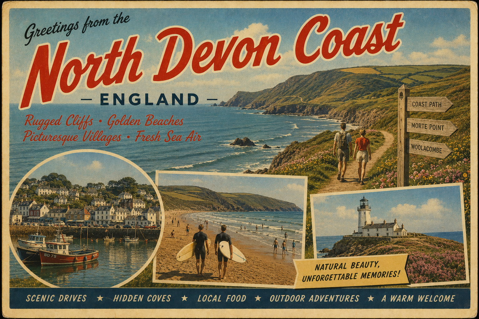
The North Devon coastline along the Bristol Channel is characterised by a mix of rocky headlands, sandy stretches, and estuarine waters. Conditions are influenced by strong tidal ranges and locally complex currents.
The coastline is generally exposed, particularly on western-facing sections, with more sheltered water found within certain estuaries and inner harbour areas, depending on state of tide and weather systems.
Local Operating Context (for Liveaboard Boaters)
This section of coast is shaped significantly by the Bristol Channel’s large tidal range, which can create fast-moving streams and rapidly changing depths in some areas. Navigation often requires careful timing and awareness of tidal state.
Anchoring opportunities may be limited in more exposed stretches, and shelter can vary considerably with wind direction and swell conditions.
Estuarine areas provide some reduction in exposure, though drying areas and shifting channels may be present in parts of the Taw and Torridge systems.
Weather patterns arriving from the Atlantic can affect conditions quickly, particularly during winter months when swell and wind exposure can increase.
Typical Conditions
- Strong tidal ranges with fast localised streams
- Moderate to heavy Atlantic swell exposure in outer coastal areas
- Variable visibility and frequent changes in wind strength
- Calmer waters mainly within estuarine systems at suitable tide states
Access & Shelter
- Limited natural shelter along exposed headlands
- Improved protection within selected estuaries at certain tides
- Harbour approaches may be affected by swell and tide timing
- Careful passage planning often required in unsettled weather
Shore Interaction
- Landing opportunities depend heavily on tidal state and local conditions
- Rocky shorelines can limit easy access in exposed sections
- Sandy beaches may be more accessible but exposed to surf
- Estuary edges may include soft mud or drying ground at low tide
Risk Factors
- Strong tidal currents and overfalls in places
- Rapidly changing sea state in westerly or south-westerly winds
- Limited safe anchorage in more exposed zones
- Shifting sands and channels in estuarine environments
Overall Character
The area has a varied and often dynamic coastal character, with conditions that can shift between relatively sheltered estuary waters and exposed Atlantic-facing stretches. Careful observation of tide and weather is generally necessary for safe passage and station-keeping.
Notable Locations
- Ilfracombe – Small harbour town offering some shelter, though conditions outside can be exposed.
- Bideford (River Torridge estuary) – Estuarine area with tidal constraints and drying sections.
- Hartland Point – Exposed headland known for strong tidal interaction and Atlantic swell exposure.
- Saunton Sands – Long sandy shoreline, generally exposed to surf and Atlantic conditions.
Practical Mooring & Anchorage Locations
Ilfracombe Harbour
- Type: Harbour
- Shelter: Protected from south-easterly through south-westerly winds
- Exposure: North-westerly swell can make the entrance and outer harbour uncomfortable
- Key Constraints: Strong tidal range in Bristol Channel; swell affects entry in Atlantic conditions; marina space can be limited
- Traffic Level: High
- Liveaboard Suitability: Medium-High
- Notes: Established working harbour with marina facilities and visitor moorings. Can become lively in unsettled Atlantic weather.
Bideford (River Torridge)
- Type: Estuary / Harbour
- Shelter: Well protected from Atlantic swell and most wind directions once inside the estuary
- Exposure: Strong tidal currents in the river and restricted depths at low water
- Key Constraints: Large tidal range; navigating the channel requires timing; shallow patches and shifting sands in parts of the estuary
- Traffic Level: Medium
- Liveaboard Suitability: Medium-High
- Notes: Offers mooring opportunities along the river with good shelter. Access is highly tide-dependent.
Appledore Harbour
- Type: Harbour / Estuary Mooring
- Shelter: Good shelter from prevailing westerlies within the estuary
- Exposure: Choppy conditions possible in strong wind against tide situations
- Key Constraints: Strong tidal streams; limited deep-water access at low tide; busy navigation channel shared with Bideford Bay approaches
- Traffic Level: Medium
- Liveaboard Suitability: Medium-High
- Notes: Popular small harbour with moorings and access to River Torridge facilities. Drying areas nearby require careful mooring selection.
Instow (River Torridge Estuary)
- Type: Estuary Anchorage / Mooring Area
- Shelter: Sheltered from Atlantic swell by sandbanks and estuary alignment
- Exposure: Open to wind funneling along the estuary and uncomfortable in strong northerly or westerly winds
- Key Constraints: Extensive drying sands at low tide; shifting channels; limited fixed infrastructure
- Traffic Level: Low-Medium
- Liveaboard Suitability: Medium
- Notes: Commonly used for temporary anchorage and small craft moorings. Positioning is highly tide and channel dependent.
Barnstaple (River Taw)
- Type: Estuary / River Mooring
- Shelter: Good protection from sea conditions once inside the estuary
- Exposure: Limited exposure to wind in open stretches of the river system
- Key Constraints: Narrowing tidal channel; strong currents; significant tidal range affecting access and depth
- Traffic Level: Medium
- Liveaboard Suitability: Medium
- Notes: Inland estuary moorings offer calm conditions compared to the outer coast. Navigation requires careful attention to tide and channel markers.
Lynmouth Harbour
- Type: Harbour
- Shelter: Limited shelter; partial protection from easterly winds
- Exposure: Highly exposed to Atlantic swell and north-westerly winds
- Key Constraints: Small harbour with restricted access; entry can be hazardous in swell; limited mooring availability
- Traffic Level: Low
- Liveaboard Suitability: Low
- Notes: Primarily a small craft harbour with seasonal use. Not suitable as a regular long-term liveaboard base due to exposure and space constraints.
Operational Support Infrastructure (Public Services)
Healthcare
Healthcare provision is generally centred in nearby towns, with smaller coastal settlements relying on regional facilities further inland. Access may require onward travel from the immediate coastline.
Emergency Services
Emergency response is coordinated through regional services, with coastal coverage supported by maritime and shore-based units where applicable. Response times may vary with location and accessibility.
Postal Services
Postal services are based in surrounding towns and villages, with rural distribution covering coastal settlements where available.
Civic Services
Civic administration is managed through local authority structures serving wider North Devon areas, including both inland and coastal communities.
Visitor Information
Visitor information is typically available in larger coastal towns and nearby regional centres, with seasonal variations in service availability.
Practical Notes for Boaters
This section will be developed over time based on direct experience and relevant contributions. The focus is on practical usefulness rather than completeness.
From the Project
Observations and notes from the ongoing boat conversion and coastal exploration project will be added here as they become available.
Related Knowledge Base
- Coastal erosion processes
- Sedimentary rock formations
- Harbour types and access
- Tidal patterns and coastal conditions
Status
This is part of a growing coastal index. Content will be expanded over time as the project develops.