





Torbay & Teignmouth Coast
Overview
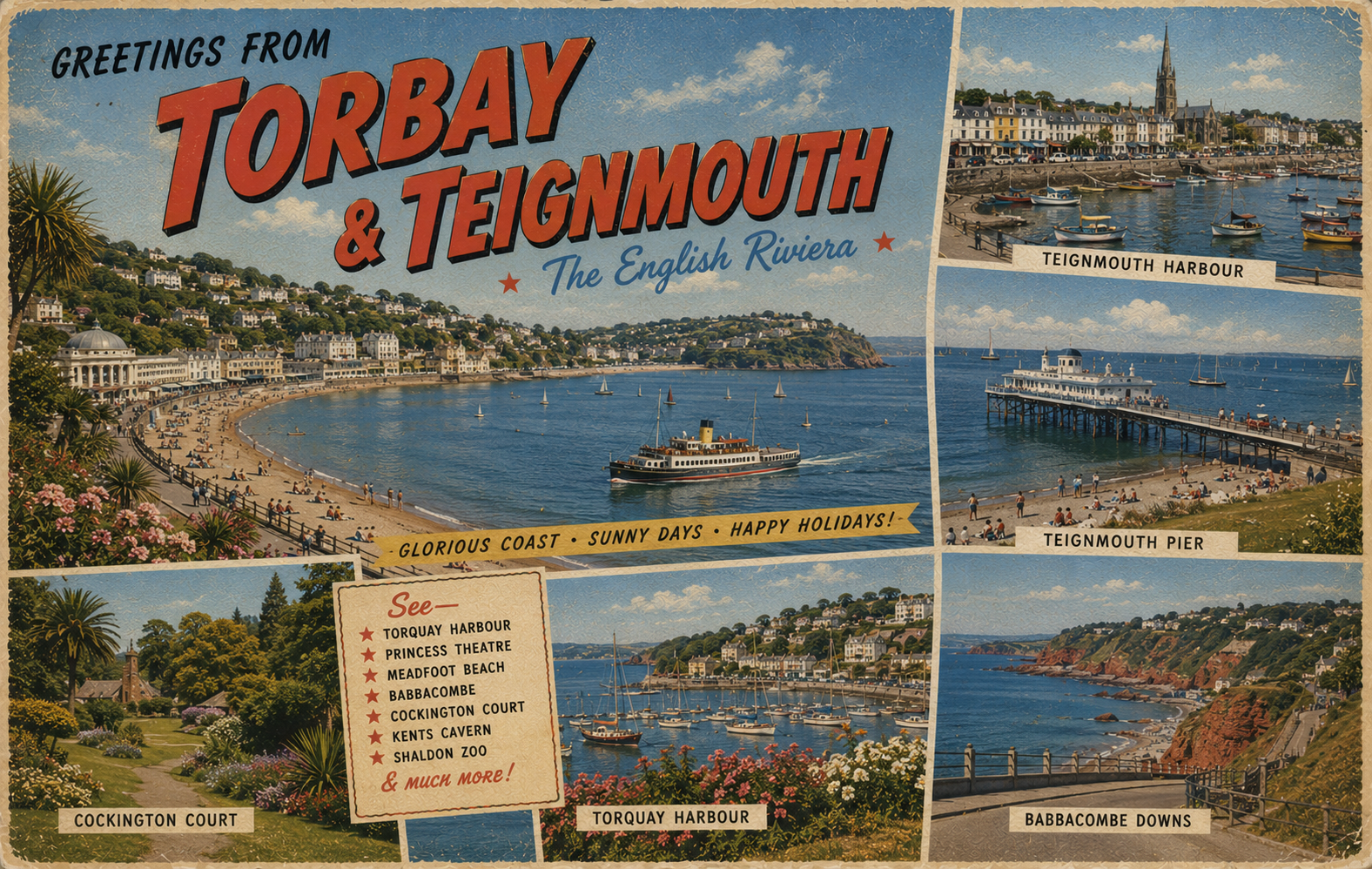
The Torbay and Teignmouth coast in South Devon forms a generally south-facing stretch of coastline with a mixture of sheltered bays and more open coastal sections. The area includes several settled coastal towns and stretches of shoreline influenced by seasonal weather systems in the English Channel.
The coastline is varied in character, with enclosed bay areas contrasted by more exposed headlands and estuary influences further north towards the River Teign.
Local Operating Context (for Liveaboard Boaters)
This section of coast is influenced by moderate tidal ranges and regular ferry and recreational traffic in busier bay areas. Conditions can change with Atlantic weather systems tracking into the Channel, particularly in winter months.
Inshore waters within bays may be comparatively calm in settled weather, though exposure increases quickly outside sheltered areas. Localised wind effects around headlands and cliffs can be significant.
Navigation is generally straightforward in settled conditions, though attention is needed in areas of mixed leisure and fishing activity, particularly during peak seasonal use.
Shallow gradients and sandy seabeds are present in parts of the bay, while other areas become deeper more quickly offshore.
Typical Conditions
- Moderate tidal influence with locally complex flows near estuaries
- Generally sheltered waters within bays in calm weather
- Exposed conditions possible around headlands and outer bay approaches
- Seasonal variation in wind and sea state, particularly in winter
Access & Shelter
- Natural bay formations may provide partial shelter in settled conditions
- Exposure increases outside enclosed coastal indentations
- Estuary areas can offer transitional shelter but may be tide-dependent
- Local seabed composition varies between sand and rock
Shore Interaction
- Multiple settled coastal towns along the bay frontage
- Mixed recreational shoreline use, particularly in summer
- Access points vary between steep coastal paths and developed waterfronts
- Shore access conditions may depend on tide and local topography
Risk Factors
- Sudden exposure to Channel weather systems
- Strong tidal streams near estuary mouths and headlands
- High seasonal leisure traffic in bay waters
- Reduced shelter in southerly or south-easterly winds outside inner bay areas
Overall Character
The area is generally coastal and settled in nature, with a balance between sheltered bay environments and more open stretches of shoreline. Conditions are typically moderate but can become challenging when Atlantic or Channel weather patterns move through the region.
Notable Locations
Torbay – Large natural bay offering varied shelter depending on position within the bay and prevailing wind direction.
Brixham Harbour – Located within Torbay, generally more enclosed waters with surrounding coastal activity influencing conditions.
Teignmouth Estuary – River mouth environment where tidal influence is significant and conditions can shift with flow.
Hope's Nose – Coastal headland near Torquay, typically more exposed with limited shelter in certain wind directions.
Practical Mooring & Anchorage Locations
Brixham Harbour
- Type: Harbour / Marina
- Shelter: Good protection from northerly and westerly winds within the inner harbour areas.
- Exposure: Surge and uncomfortable conditions can develop during strong southerly or south-easterly winds.
- Key Constraints: Busy fishing and leisure traffic; allocated berths and harbour controls apply.
- Traffic Level: High
- Liveaboard Suitability: Medium
- Notes: One of the main all-weather harbour options in the area. Services and shore access are well established.
Torquay Marina
- Type: Marina
- Shelter: Well sheltered from westerly and northerly conditions inside the marina.
- Exposure: Southerly swell can affect outer harbour areas during strong weather systems.
- Key Constraints: Seasonal congestion and marina fees; manoeuvring space can become limited in summer.
- Traffic Level: High
- Liveaboard Suitability: Medium
- Notes: Protected marina environment with reliable access in most conditions. High recreational vessel activity in peak season.
Dartmouth Harbour
- Type: Harbour / River Mooring
- Shelter: Strong shelter from most wind directions once inside the River Dart.
- Exposure: Entrance conditions can become rough during strong easterly or south-easterly weather.
- Key Constraints: Strong tidal streams in places; regulated mooring areas and commercial traffic.
- Traffic Level: High
- Liveaboard Suitability: High
- Notes: Widely used for longer stays and sheltered river moorings. Good shoreside support and marine facilities.
Teignmouth Harbour
- Type: Harbour / Estuary
- Shelter: Partial shelter within the estuary from westerly and north-westerly conditions.
- Exposure: Exposed to swell and difficult entrance conditions during strong easterlies or onshore weather.
- Key Constraints: Shifting sands, tidal limitations, and bar conditions at the harbour entrance.
- Traffic Level: Medium
- Liveaboard Suitability: Medium
- Notes: Access suitability depends heavily on tide and weather. Inner estuary areas are calmer than outer approaches.
River Teign Moorings
- Type: River Mooring
- Shelter: Generally sheltered from most wind directions further upriver.
- Exposure: Less comfortable during strong easterly weather and periods of heavy river flow.
- Key Constraints: Tidal currents, shallow sections, and local mooring availability restrictions.
- Traffic Level: Medium
- Liveaboard Suitability: Medium
- Notes: More sheltered than exposed coastal anchorages nearby. Practical mainly for shallow to moderate draft vessels.
Fishcombe Cove
- Type: Anchorage
- Shelter: Offers reasonable shelter from northerly and north-westerly winds within Torbay.
- Exposure: Poor holding comfort in strong southerly or easterly weather.
- Key Constraints: Limited space and entirely weather dependent for overnight use.
- Traffic Level: Medium
- Liveaboard Suitability: Low
- Notes: Common short-stay anchorage in settled conditions. Not suitable as a reliable long-term base.
Operational Support Infrastructure (Public Services)
Healthcare
Healthcare services are concentrated in nearby coastal towns and inland urban centres, with access typically dependent on transport links from the immediate shoreline.
Emergency Services
Coastal emergency coverage is provided through regional maritime and land-based response services, with response times influenced by local access routes and weather conditions.
Postal Services
Postal provision is available within the main settlements along the coast, with varying levels of service in smaller surrounding communities.
Civic Services
Civic administration is managed through local authority structures serving the wider South Devon area, covering coastal and inland communities.
Visitor Information
Information services are generally located in the main coastal towns, with seasonal availability more common in peak visitor periods.
Practical Notes for Boaters
This section will be developed over time based on direct experience and relevant contributions. The focus is on practical usefulness rather than completeness.
From the Project
Observations and notes from the ongoing boat conversion and coastal exploration project will be added here as they become available.
Related Knowledge Base
- Coastal erosion processes
- Sedimentary rock formations
- Harbour types and access
- Tidal patterns and coastal conditions
Status
This is part of a growing coastal index. Content will be expanded over time as the project develops.
