




Angus Coast
Overview
The Angus Coast lies along the eastern seaboard of Scotland, facing the North Sea. It is characterised by a mix of low-lying stretches, sandy bays, and sections of more rugged red sandstone cliffs. The coastline is relatively open, with limited natural shelter, and conditions are often shaped by prevailing easterly winds and North Sea weather systems.
Local Operating Context (for Liveaboard Boaters)
Typical Conditions
- Sea state can become moderate to rough in onshore winds, particularly from the east and north-east
- Tidal streams are present but generally less pronounced than in more constrained coastal areas
- Weather patterns may change quickly, especially with North Sea systems moving in
- Visibility can be reduced at times due to sea mist or haar, particularly in warmer months
Access & Shelter
- Natural shelter along this stretch is limited, with few deeply indented bays
- Harbour access points exist but are often exposed to certain wind directions
- Approaches may require caution in swell conditions, particularly where entrances face eastward
- Holding ground varies, with sand and mud in some areas, though exposure remains a consideration
Shore Interaction
- Shore access is generally straightforward in settled conditions, particularly near sandy beaches
- Cliff-backed sections restrict landing opportunities and require careful assessment
- Tidal range can expose broad areas of sand and mud, affecting landing points
- Some coastal settlements provide indirect access to inland transport and services
Risk Factors
- Exposure to North Sea conditions can lead to uncomfortable or hazardous seas
- Limited all-weather refuge points increase reliance on forecast planning
- Sea fog (haar) may reduce visibility with little warning
- Shallow areas and shifting sands in certain locations require attention to charts and tides
Overall Character
The Angus Coast presents an open and at times austere coastal environment, where planning and weather awareness are important. It is not heavily sheltered, and opportunities for extended stationary periods may depend on favourable conditions. The area suits those prepared for a degree of exposure and variability typical of the North Sea coastline.
Notable Locations
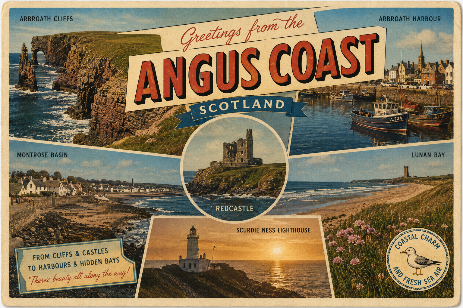
Arbroath – A coastal town with a harbour that may offer limited refuge, though entrance conditions can be affected by easterly swell.
Montrose Basin – A tidal estuary providing more sheltered waters inland, with access governed by tidal states and shifting channels.
Lunan Bay – A wide sandy bay with open exposure, offering temporary anchorage in settled weather but little protection in onshore winds.
Red Head – A prominent headland marking a change in coastal character, often subject to stronger tidal movement and exposed sea conditions.
Practical Mooring & Anchorage Locations
Arbroath Harbour
- Type: Harbour
- Shelter: West through south-west winds
- Exposure: East and north-east swell can make entrance and berths uncomfortable
- Key Constraints: Entrance can be affected by swell and tidal set; limited space during peak fishing activity
- Traffic Level: High
- Liveaboard Suitability: Medium
- Notes: Established working harbour with basic services and shelter in settled conditions. Can be uncomfortable in prolonged easterly weather.
Montrose Port
- Type: Harbour
- Shelter: Good shelter from most directions once inside the river approach, especially westerly and southerly winds
- Exposure: Outer approach exposed to North Sea swell and easterly conditions
- Key Constraints: Tidal access via River South Esk; commercial shipping movements and lock/port procedures may apply
- Traffic Level: Medium
- Liveaboard Suitability: High
- Notes: One of the more practical all-round sheltered options on the Angus coast. Strong refuge once inside the river system.
Montrose Basin
- Type: Estuary
- Shelter: Well sheltered from most wind directions once inside the basin
- Exposure: Entrance channel exposed to tides, shallow banks, and shifting sands
- Key Constraints: Strong tidal dependence for entry and exit; extensive mudflats at low water restrict movement
- Traffic Level: Low
- Liveaboard Suitability: Medium
- Notes: Offers calm waters suitable for short-term anchorage in suitable tide windows. Navigation requires careful attention to channels and timing.
Lunan Bay
- Type: Anchorage
- Shelter: Limited shelter; best in light westerly or settled conditions
- Exposure: Fully exposed to east and north-east swell
- Key Constraints: No formal harbour facilities; holding can be variable depending on seabed conditions
- Traffic Level: Low
- Liveaboard Suitability: Low
- Notes: Wide sandy bay suitable only for temporary anchorage in calm weather. Not suitable for prolonged stays in unsettled North Sea conditions.
Ferryden (River South Esk Approach)
- Type: River Mooring
- Shelter: Good shelter from coastal swell and most wind directions once inside the river
- Exposure: Approach channel exposed to tide and outer North Sea conditions
- Key Constraints: Tidal access required; proximity to Montrose Port operations and navigation channels
- Traffic Level: Medium
- Liveaboard Suitability: Medium
- Notes: Small settlement opposite Montrose offering access to sheltered river waters. Best used in conjunction with Montrose Basin or port access planning.
Practical Notes for Boaters
This section will be developed over time based on direct experience and relevant contributions. The focus is on practical usefulness rather than completeness.
From the Project
Observations and notes from the ongoing boat conversion and coastal exploration project will be added here as they become available.
Related Knowledge Base
- Coastal erosion processes
- Sedimentary rock formations
- Harbour types and access
- Tidal patterns and coastal conditions
Status
This is part of a growing coastal index. Content will be expanded over time as the project develops.